Ancient Maps
Maps of Cyprus as they appeared in the first Atlases, Isolaria and other publications following the discovery of typography.

16th century map of Cyprus
Map of Cyprus by Ioannis Honterus, found in his "Cosmographiae rudimentis..", Basle 1561. Wood: Basswood Width: 295mm Height: 195mm 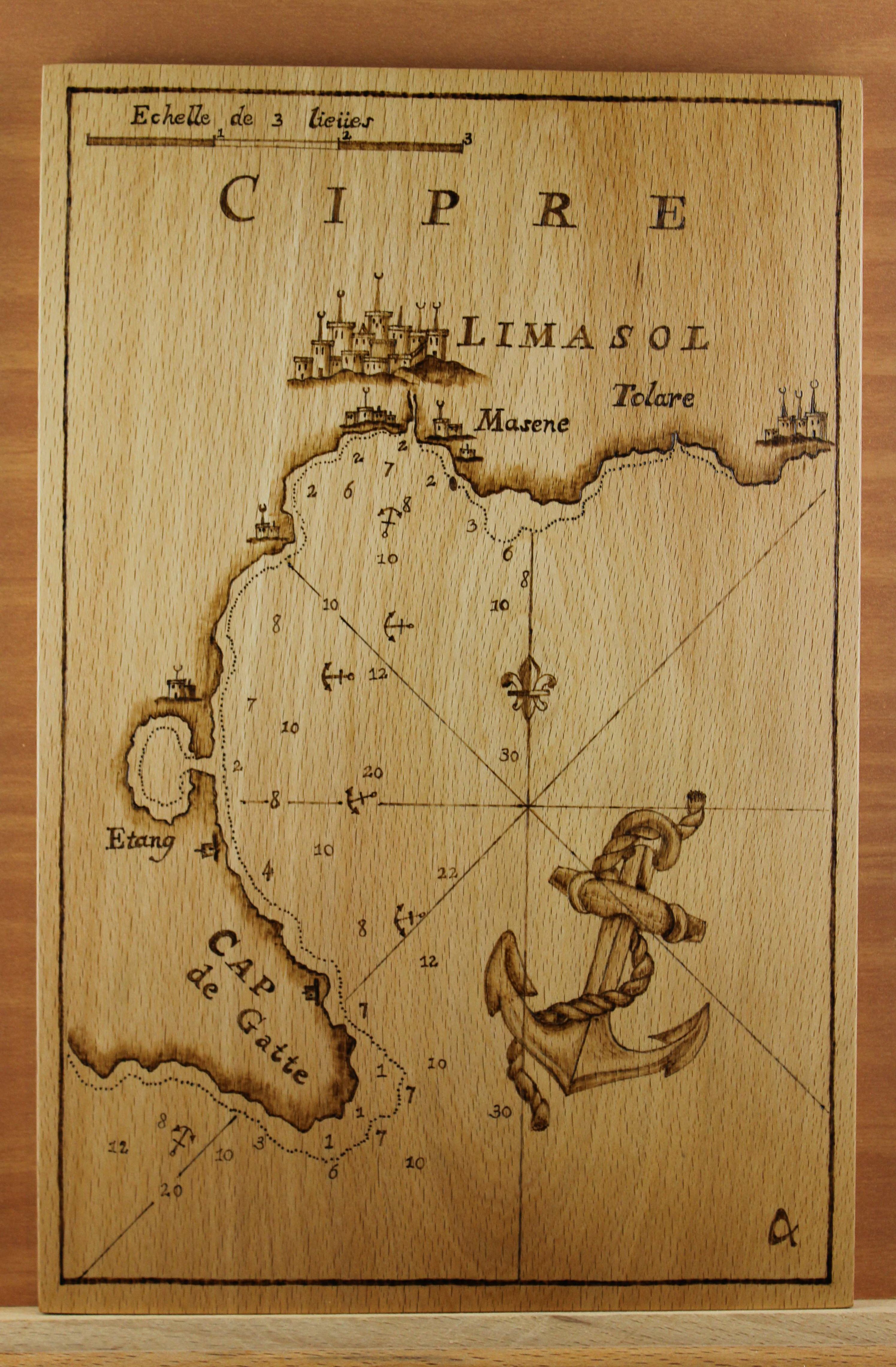
Nautical Chart of Limassol
By Joseph Roux, 1764AD Wood: Beech Width: 195mm Height: 295mm |

16th century map of Cyprus
Map of Cyprus by Ioannis Honterus, found in his "Cosmographiae rudimentis..", Basle 1561. Background text excerpt from “Strabonis Rerum geographicarum” Wood: Maple Width: 380mm Height: 300mm 
Map of Cyprus
1661AD Wood: Maple Width: 280mm Height: 205mm |

17th century map of Cyprus
Map of Cyprus of the 17th century. By Jacques Peetes (Antwerp) 1685. Wood: Basswood Width: 330mm Height: 250mm 
Nautical Chart of Larnaca
By Joseph Roux, 1764AD Wood: Poplar Width: 215mm Height: 155mm |
